home

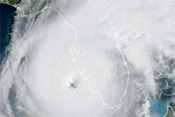
Ian Eyewall Makes Landfall

At 1:05 pm ET, NBC posted this photo:
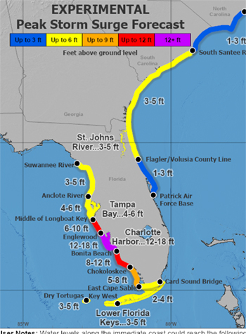
Two hours ago, the National Weather Service had this map:
The latest forecast: [More...]

On the forecast track, the center of Ian is expected to move onshore within the hurricane warning area in a few hours, move over central Florida tonight and Thursday morning and emerge over the western Atlantic by late Thursday. Ian is forecast to turn northward on Friday and approach the northeastern Florida, Georgia and South Carolina coasts late Friday.

Maximum sustained winds remain near 155 mph (250 km/h) with higher gusts. Ian is a category 4 hurricane on the Saffir-Simpson Hurricane Wind Scale. Ian is forecast to make landfall on the west coast of Florida as a catastrophic hurricane. Weakening is expected after landfall, but Ian could be near hurricane strength when it moves over the Florida East coast tomorrow, and when it approaches the northeastern Florida, Georgia and South Carolina coasts late Friday.

< Hurricane Ian: "Know Your Zone" | Happy Birthday (Mine) and Open Thread >
  • The Online Magazine with Liberal coverage of crime-related political and injustice news

  • Contribute To TalkLeft


  • Display: Sort:
    Every time I look at that NBC sat. photo of Ian, (5.00 / 1) (#1)
    by leap2 on Wed Oct 05, 2022 at 10:02:51 AM EST
    I see a fat, round belly and pupik. I can't not see that.